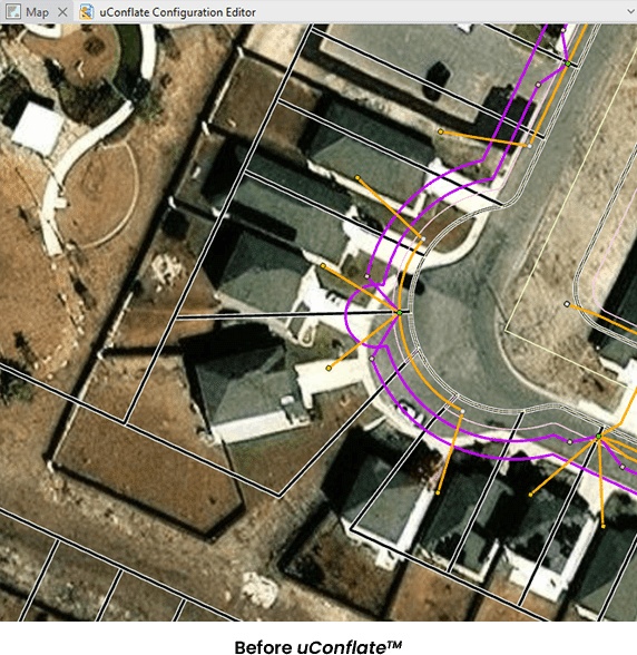
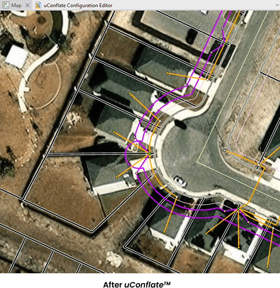
Across North America, electric, gas, pipeline, and telecommunications providers are under pressure to expand their networks, modernize their infrastructure, and meet stringent regulatory demands. Yet a silent problem holds many back—inaccurate geospatial data, outdated maps, and mismatched datasets create a ripple effect across operations—leading to delays, unplanned costs, and compliance risks. Manual conflation processes, which once filled the gap, are now proving too slow, resource-intensive, and inconsistent for industries that require agility.
That is why more organizations are turning to automation-driven GIS conflation tools like uConflate™.